_page-0001%20(1)%20Peque%C3%B1o.png)
Bartholomew Island
Description: Bartolome Island is a volcanic islet just off the east coast of the Santiago Island.
It is one of the youngest islands in the Galapagos Archipelago.
It is named after Lieutenant David Bartholomew of the British Navy.
Surface: 1.2 Km2
Landscapes: this island offers some of the most beautiful landscapes in the archipelago.
The island formation consists of an extinct volcano and a variety of volcanic formations in bright red, orange, green, and black colors.
Height: A volcano more than 100 meters high marks the island.
Flora and Fauna: It is not famous for its fauna but it is famous for its lava landscape that seems almost unreal and makes it possible to trace the evolution of the islands.
The Beach: Most cruisesThey stop at the spectacular and famous Pinaculo Rock, the best known on Bartolomé Island.
If you take a panga (small boat) ride you might see, with a little luck, the small and friendly Galapagos penguin; Furthermore, this is the only type of penguin that exists north of Ecuador.
Pinnacle Rock: Pinnacle Rock houses the twin bays, the main feature of the island.
Of course The underwater world of Galapagos it is truly impressive, and it is here where you can perform dive or simply swim with: penguins, sea turtles and other tropical fish.
Twin Bays:
The twin bays are connected by a narrow isthmus.
On the other side you will have the unique possibility of observing female sea turtles (depending on the season) that are waiting for the night in the water of the bay in order to lay their eggs on the beach.
Ladder:
The most outstanding point of all the visits to the islands is without a doubt the excursion to the top of a volcano.
A walk of about 40 minutes will take you to the top of a wooden staircase and walkways.
Staircase Landscape: The landscape is made up of plants that have adapted to dryness such as cacti, something so strange that it seems like something from space.
When you reach the top, the spectacular view of the place will undoubtedly leave you breathless.
Photographs: This is the most photographed place in the Galapagos that should not be missing from any photo album. Here you will be able to appreciate: the twin bay, the Pinnacle Rock, the lunar landscape, as well as the underwater crater.
In addition, you will be able to see Santiago Island, which is nearby, and its famous Sullivan Bay, which is fascinating.
Recommendations: finally, it is advisable not to approach the exhausted animals because they could scare them.
Additional; Due to the dazzling sun in the afternoon, it is recommended to do this walk in the morning, where you can have an extraordinary view!
Chinese Hat Island
Chinese Hat is a small island near the southeast of Santiago Island, whose surface area is less than a quarter of a kilometer in size.
This Island has the shape of a recently volcanic cone, which explains its descriptive name; It is shaped from the front down like a Chinese hat.
The shape of the hat can be best appreciated from the north side. In front of Sombrero Chino, on the rocky coast near Santiago, you can often see penguins (fauna) of Galapagos.
A short 400 meter long path goes around the cove and through a colony of sea lions and marine iguanas that cover the landscape.
The volcanic scenery of Archipelago it is attractive, and there are very good images of the cone. There is the possibility of snorkeling and swimming in the cove.
Greater Daphne Island
Greater Daphne has a size of 0.32 square kilometers, and is the larger of the two Daphne Islands (Lesser Daphne-0.07 square kilometers) extending about 10 km west of Seymour. (Galapagos Archipelago)
Daphne Lesser is the smaller one not open to visitors, you can explore the larger trail up a steep path to the 120 meter high summit.
At the top of cone two, small craters are the nesting site of hundreds of blue-footed boobies.
The Piqueros (fauna) of Nazca nest on the edges of the crater and with some luck you can also see red-billed tropical birds nesting in the crevices of the rocky cliffs of the islands.
Landing on the rocky cliffs of the islands is quite difficult, due to the fragile eroded slopes.
The authorities of Galapagos National ParkThey have limited visits to the island.
Espanola Island
Española Island is located in the extreme southeast of the Archipelago and is considered, along with Santa Fe, one of the oldest, approximately four million years old.
The boat trip from the Island Santa Cruz to Española, it takes around 10 to 12 hours.
Visitors come to see the albatrosses and the mating dances of the blue-footed boobies in this area.
Due to its great variety of seabirds, this island is very popular with bird watchers; You can find masked boobies, blue-footed boobies, Galapagos gulls, red-billed birds, mockingbirds, swallow-tailed gulls and, most importantly, albatrosses.
There are two places to visit: Gardner Bay and Punta Suárez.
Gardner Bay:
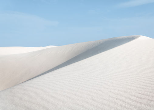
Gardner Bay is a beach about 1 km long that is among the most beautiful in all Galapagos.
It is home to many colonies of sea lions, and its turquoise water makes a beautiful contrast to the white sand that consists of shell dust.
Large marine iguanas and zayapas mix on the rocks.
Mockingbirds fight for their territory, which inspect tourists' backpacks. About 50 m from the coast is a rock where you will find tropical fish and rays, while you snorkel.
One of the spectacular sights in the Galapagos is Gardner Rock, which can be reached by panga.
This is the home of whitetip reef sharks and other sea inhabitants.
Punta Suarez:
Punta Suárez is located at the western end of the island of Española.
The tourist trail is about 2 km long and goes from one end of the island to the other, where the spectacular bird life (fauna) it can be seen.
There are many blue-footed boobies nesting in this place, so you should be careful not to step on any of their nests (depending on the season).
You may spot red marine iguanas sprawled in the sun or buzzards high in the trees hunting juvenile blue-footed boobies.
Following the path you can find masked boobies that are nesting almost all year round on the cliffs.
The highlight of the tour is without a doubt the colony of Galapagos albatrosses, endemic to this island, which are not found anywhere else on the islands or in the world.
In mid-March and the end of December there are around 12,000 birds of this fascinating species, which have wingspans of around 2.40 m.
On the cliffs they seem really uncomfortable but when they fly, they are the kings of the sky.
A very short distance from the albatross colony is the Hueco Soplador; This is a water feature up to 20m (50-75ft) high that has been created by waves.
All the energy is pressed through a small hole between the cliff, the phenomenon of which resembles a geyser.


Floreana Island
Floreana Island was named after Juan José Flores, the first president of Ecuador and during whose administration, the government of Ecuador took possession of the archipelago.
It is also called Santa María because of one of Christopher Columbus' caravels. It has an area of 173 km2 and a maximum altitude of 640 meters.
This is one of the islands with the most interesting human history and one of the first to be inhabited. Pink flamingos and green sea turtle nests (fauna) are found on this island (December to May).
Also found here is a nocturnal seabird which spends most of its life away from land.
Floreana was the first island to be inhabited. The history of this Island is very exciting because it includes mystery in the deaths of some inhabitants that until today have not been solved.
If you are interested in the whole story, then you can read Margaret Wittmer's book “Floreana”. She lived for more than 60 years on Floreana and died at the age of 95 in 2000. Her descendants run a hotel on the island to this day.
Peace Asylum:
Asilo de la Paz (450 m mountain) wonderful place to visit, which is located a few kilometers on the island from Puerto Velasco Ibarra.
Due to the fresh water, this area was inhabited by the first settlers, who found refuge in the nearby caves. In this place, you can easily observe the endemic Medium Tree Finch.
Post Office Bay:
On the north coast is Post Office Bay. In the early 1800s, whalers began leaving their mail in a barrel and taking letters from other sailors heading to their destination.
This tradition is still practiced by tourists (of course the barrel is no longer the original).
The idea is to take the letters or postcards to their destination manually. In addition to being the post office, this was the landing site for some of the first settlers.
Cormorant Point:
Punta Cormorant is a light green beach (due to olivine crystals) located between two tuff cones, a colony of sea lions. The trail (100 me) ascends to a lagoon that is popular with flamingos.
Usually you can see a few dozen flamingos there, as well as oystercatchers, White-winged Sandpipers, Curlews, Royal Wrens, and Patillos. It is also advisable to look at the sky because the hawks of Galapagos they hover over the lagoon.
The trail crosses the isthmus to a beautiful and incredible beach with white sand where you can go swimming. Whitetip and stingray sharks are common here, shuffling when walking in the water.
From December to March the green sea turtles of the Pacific use this place to dig their eggs.
Devil's Crown:
One of the most wonderful places to snorkel is Corona del Diablo, a semi-submerged volcanic crater.
The interior is sandy and protected from waves, outside the currents can be very strong. There are some tunnels under water to be explored.
The area is home to a large number of colorful fish, sea turtles and sometimes you can also find sharks. For divers and swimmersYou can't miss this opportunity!
Fernandina Island
Fernandina is the third largest, and youngest, of the islands of Galapagos.
The Island is a layer of the active volcano that last erupted in August 2007; was formed by the hot spot of Galapagos. The southern flank of the volcano had an eruption that generated flows, which decreased over the hours. This is the youngest and westernmost island of the archipelago.
It was named in honor of King Ferdinand of Spain, who sponsored the voyage of Christopher Columbus. On February 14, 1825, while anchoring in Bancos Bay, Captain Benajamin Morrell recorded one of the largest eruptions in Galapagos history from the Fernandina Volcano.
His ship was put into safekeeping and his account of the event was preserved; In addition, Fernandina has an area of 642 km2 and an altitude of 1,476 meters (4,842 feet), with a caldera around 6.5 km wide.
The caldera collapsed in 1968, when parts of the caldera floor fell 350 meters. A small lake has intermittently occupied the northern caldera floor, most recently in 1988.
Due to recent volcanic activity, the island does not have much life and has rather a gray environment. Visitors to Fernandina Island will be taken to see only the slopes of the crater for safety reasons.
Punta Espinoza, located on the northeast coast of the island, is a narrow strip of land where hundreds of marine iguanas (fauna) gather in large groups on black lava rocks.
The famous flightless cormorant lives on this island as well as penguins, pelicans and sea lions. Two types of lava flows can be observed. Additionally, the mangroves (flora) are also abundant on the island.
Genovesa Island
Genovesa Island it occupies about 14 km2 and its maximum elevation is 64 m. The horseshoe-shaped island has a volcanic caldera whose wall has collapsed, forming the large Darwin Bay, which is surrounded by cliffs.
The centrally located Arcturus Lagoon is filled with salt water and the sediments in its crater are less than 6,000 years old. Although no historical eruptions are known from Genovesa, there are relatively young lava flows on the flanks of the volcano.
This outlying island is located in the northeastern part of the archipelago. Many cruises cannot include it due to the long distance that must be traveled to get there, which takes approximately 8 hours each way.
Darwin Bay, on the south coast, is almost landlocked and surrounded by high cliffs. The water is full of microscopic marine life and for that reason many people associate it with green pea soup.
Darwin Bay Beach is a coral beach, where a 750m path takes you past more seabird colonies.
There is also the possibility of taking a panga (boat), on which trip you will often be accompanied by sea lions. Here, you will be able to observe the cliffs from the sea side, which are home to large colonies of red-footed boobies.
The red footed boobyIt is the smallest type of booby and the only one that currently builds a nest in trees or on cliffs to protect itself from predators.
The cliff:
It is an extraordinary steep path, which will take you through a colony of seabirds full of life, up to the cliffs that are 25 m high.
At the top of the tour you will continue inland, passing more colonies of seabirds that are in a Palo Santo (Bursa Tree) forest.
Leaving the forest you can see a rock plain, where masked boobies and red-footed boobies, wonderful frigates, swallow-tailed gulls, red-billed tropical birds and hundreds of swallows.GalapagosThey are located on the edge of the cliff.
Galapagos swallows are different from others in the world because they fly around all day to avoid predators and return at night to their nests made in holes.
Genovesa also offers a great opportunity to snorkel, although the water here is a little murky, due to its proximity to the beach, and the view of the cliffs is better.
Due to its nutritional wealth, the bay is often full of marine iguanas and is also visited by young hammerhead sharks.
As you cross the Equator Line on your way, there are many cruises that include “Ecuador – baptisms” for passengers who have not crossed the line at sea before.
Mosquera Island
Mosquera is a small island in the Archipelago (Galapagos) of sand of 0.06 square meters that is located between the Baltra Island and the Seymour Island. Furthermore, in most of the perimeter there is a rock base that shows the rise of lava.
It is worth mentioning that there is no road, but there is a sandbank where visitors have the opportunity to observe and even swim with sea lions (fauna) from a large local colony.
The entire area is completely open; However, visitors are always informed to be very careful not to step on the little vegetation (flora) that exists, plus they do not disturb the wolves while they sleep.
Some nests of lava gulls have been found. They nest in open areas without protection. Consequently, if they are disturbed, they become very nervous and may abandon their nests.
Regarding the fauna we can observe: Birds such as herons, lava gulls, ruddy turnstones and sandpipers can also be spotted here.
Additionally, this Island has one of the largest populations of sea lions; Consequently, visitors are advised to keep their distance from the sea lions, especially the males, which are sometimes a bit aggressive.
Activities that can be performed:
-
Snorkel
-
Walk on the beach
-
Enjoy animal life
Seymour Island
North Seymour Island in Galapagos it was raised from the seabed by a seismic event, and its origins as a seabed, emerged from the island from the lowest point, with a flat profile, until its highest point reached only 30 m high.
The cliffs of the small island (1.9 km 2), only a few meters high, form the coastline, where the seagulls (fauna) with forked tails perch on ledges.
A small forest of palo santo trees (flora) silvery gray, above the plateau (dry landing on black lava rocks), usually without leaves, waiting for rain to bloom.
The island is full of life! and you may have to give way to a sea lion or iguana.
Blue-footed boobies nest on both sides of the road (almost 2 km) where pairs do their courtship dance to mate.
Furthermore, along the rocky coast a remnant of white sand remains in the sea and long flocks of seabirds come together for an impressive feeding spectacle.
The trail turns inland to reveal the largest nesting site in the Galapagos of the wonderful frigate bird. These enormous, dark acrobats, with a wingspan of 5 feet, the males, with inflated red pouches, sit precariously in low bushes to care for their equally large chicks.
Swallow-tailed gulls also nest here and other birds are also often seen. Sea lions and endemic black marine iguanas are common, and with a bit of luck land iguanas and sea lions can be seen as well.
South Plaza Island
Only the southern island of the two small, crescent-shaped islands, which lie a few hundred meters off the east coast of Santa Cruz, you can only visit the northern part of the island for scientific purposes.
Plaza Sur is one of the smallest, but also the richest of the islands of the archipelago. Only 130 meters wide (426 feet), it was formed by a tectonic massif, giving it the shape of a tilted tabletop.
The unusual vegetation and location of the island creates an interesting landscape in which the fauna and the flora Galapagos have been improved.
On the other hand, despite its small size, some of the most interesting and outstanding species of the archipelago are found here.
It is possible to guarantee the observation of land iguanas that often remain in the shadow of the cacti. Nesting on the rugged southern cliffs are usually swallow-tailed gulls, which can be seen with a variety of seabirds.
The protected rocky coast is prime habitat for a large colony of noisy fur seals.
The main attraction of Plazas are the land iguanas, sea lions and swallow-tailed gulls. You can also see yellow-tailed mullet, Audubon's shearwater, red-billed tropicbirds, frigate birds, and brown pelicans gliding over the cliff.
Disembarking in the channel between North and South Plazas, where the island slopes towards the water.
The approach makes for a very colorful spectacle! The turquoise waters of the canal contrast brilliantly with the black lava of the banks.
Thick green algae have grown on the rocks in some places, dotted with the bright orange color of the zayapaz. Further up the shore a carpet of scarlet ice plant (Sesuvium) serves as cover for a forest of luminescent green cacti.
Yellow-gray land iguanas sit below, patiently waiting for the prickly pears to fall.
The trail gradually follows the slope of the island to the cliff overlooking the southern sea, where swallow-tailed gulls nest, Nazca boobies and blue-footed boobies stroll in the wind currents.
As you pass along the top of the cliff, you will be able to see lots of marine life, including manta rays. Surf an inlet on the western corner of the island, where a colony of male fur seals have made their home, known as the bachelor site.
The oil from their skin that they leave on the rocks makes them look polished and shiny.
Rabida Island
Rábida Island is located south of the Santiago Island.
The landing site on this 5 km2 island is a dark red beach which is usually frequented by sea lions. Here you can swim and snorkel.
The salt flats are used by brown pelicans for nesting during the season.
A trail leads to a saltwater lagoon where you can occasionally find flamingos and white-cheeked swallow ducks. (fauna)
This is also home to a colony of single sea lions who are waiting their turn to take over a colony. Continuing into the interior of the island you reach the arid area of the island where the Palo Santo trees grow (Bursa Tree).
Rábida offers the most diversified volcanic rocks in the entire archipelago. It is also an exceptional spot for snorkeling where you can find a wide variety of tropical fish.
Santiago Island
Santiago is the fourth largest island and has several excellent places to visit within its 585 km2.
On a long, flat coast of black lava with eroded shapes forming lava pools, caves and inlets that are home to a wide variety of wildlife.
The landscape is made up of scoria and numerous tuff cones and extensive, recent lava flows from the east and south of the island.
A main volcano dominates the western side, which has thick vegetation and is highly eroded. This island has almost all vegetation zones, from arid to humid.
Puerto Egas:
The wet landing on the dark sands of Puerto Egas (James Bay) leads to one of the most rewarding visits in the Galapagos Islands.
First, a trail takes us inside the remains of a salt mining operation, one of several unsuccessful attempts to commercialize the Galapagos.
Some groups will make the 1-hour round trip to the Sugarloaf Volcano (approximately 1000 feet/395 m altitude). Q
ero is the Seal Grotto that produces the greatest pleasure for visitors. Here you can get up close and personal with sea lions and sea lions in a series of rock pools.
For many, this is the only opportunity to see the Galapagos fur seal, once thought to be on the brink of extinction; However, from Playa Negra it is possible to experience one of the most exuberant snorkeling sessions during your visit.
Darwin describes his visit to the Bay of Santiago in his writing “Voyage of the Beagle.”
Sullivan Bay:
Across a narrow channel west of Bartholomew is Sullivan's Bay on Santiago Island.
This landing offers one of the most prominent volcanic sites in the Galapagos, giving us a good opportunity to see a “recent” lava flow approximately 100 years old.
Just over a century ago, the island gave birth to a lava field called pahoehoe (“stringed” in Hawaiian), which shines like a gigantic obsidian sculpture.
You can imagine the agitation of lava once molten illuminating the land, which flows into the sea, and also sends very hot smoke into the air.
On the lava surface it is possible to see some trees that were dragged by the flow of fresh lava.
The flow gave birth to new lands as it engulfed vegetation, leaving some plants forever rooted in the earth, while other plants are beginning to colonize the lava crevices.
Today the flow is presented as a gallery of abstract shapes that look like braids, curtains and spinning fans. Brightly colored “painted lobsters” and “lava lizards” punctuate the volcanic black canvas, as does the occasional finger of lava and cacti on an expansive wet carpet.
Looking back across the bay to the source of the flow, a cinder cone of reddish lava, you will be able to observe the Pinnacle Rock, which is close to Bartolomé Island.
Santa Fe Island
Santa Fe Island in the Galapagos Archipelago it was formed by lava flows that were extruded beneath the sea and later uplifted (although recent evidence suggests later sub-aerial activity).
The 24 square kilometer island is crisscrossed by a series of parallel cliffs formed by fault activity.
This island has lavas that are 3.9 million years old, making it the oldest dated island in the archipelago.
Santa Fe offers one of the most beautiful and protected coves on the islands. Its turquoise lagoon is protected by a peninsula of small islets forming an ideal anchorage.
The island occupies the south-east of Santa Cruz within sight of Puerto Ayora.
Geologically it is one of the oldest islands in the archipelago and for many years it was thought to be the product of an uplift event. Through satellite images it has been possible to determine the volcanic origin of the island.
A wet landing on a white sand beach brings visitors into contact with one of the many colonies of sea lions.
Males vie for the right to be Beach Boss, while smaller males pose as females so they can mate indirectly.
Falcons (fauna) of the Galapagos are often easily approached, high in the sal bushes, and an ascending path leads towards the cliffs, where dense scrub remains on the interior side.
The edge of the cliff gives us a wide view of the ocean. The Cactus (flora) giant stands here living up to its name, with tree trunks.
Below the cacti, some are subspecies endemic to the island, endemic species of land iguanas can be found waiting in the shade of flowers or fruits for them to fall and become a delicious part of their diet.
